
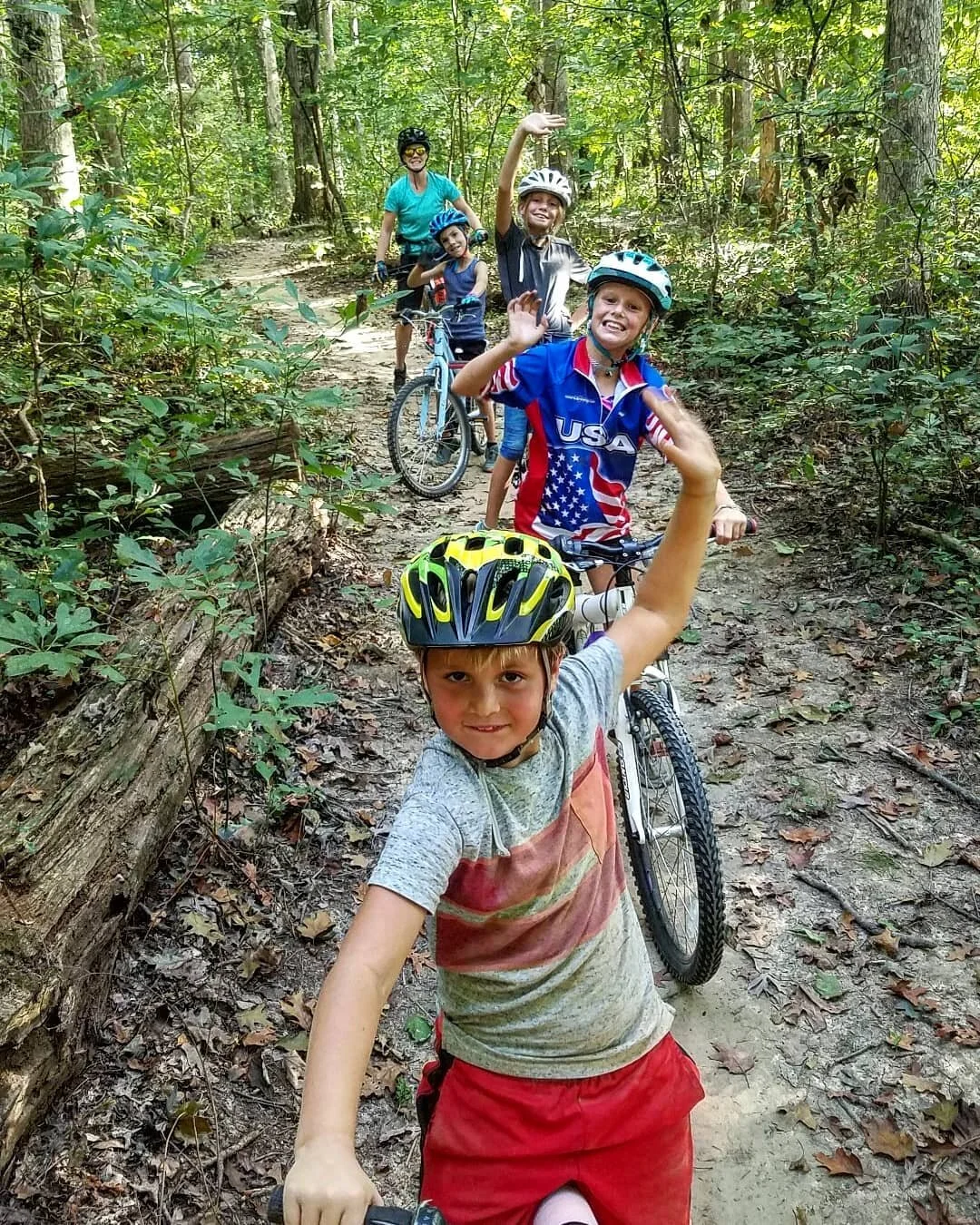
You finally got that new bike and now you’re ready to explore the paved or unpaved trails in the area. To make it easier to get out and explore we have compiled these lists of open to the public trails in Indiana, Kentucky, and beyond for you to use! ( we also tried to include driving time if you depart from the bike shop)
Protected Biking/Walking Paved Trails

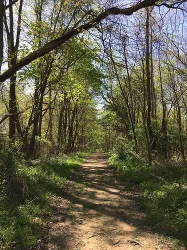
Friedman Park & the Warrick Trails
Friedman Park in Newburgh, Indiana is home to the perfect trails to try your new or recently revived bicycle out for the first time and it is only 5 minutes away from the bike shop. You’ll find plenty of freshly paved biking and walking trails, water, rest stops in the shade, restrooms, and parking in this park so don’t worry about packing everything and the kitchen sink on this trip. Remember to wear your helmet and be respectful to other trail users, please!

Friedman Park has walking/biking trails, wooded nature trails, sheltered picnic areas, playgrounds, and outdoor amphitheater, and multiple restroom locations throughout!

Pigeon Creek Greenway
Evansville’s Pigeon Creek Greenway Passage is 6.75 miles of separated and protected urban trail that connects the city’s core (about 15-20 minutes from the bike shop). Sections and Landmarks of the Pigeon Creek Greenway Include the Riverfront Corridor, Industrial Corridor, the Marchand Bridge Overlook, Shirley James Gateway Plaza, Mid Levee Corridor, Virginia Street Multi-Use Trail, Oak Hill Multi-Use Trail and Bike Route, North Main Street Multi-Use Trail, the Hi-Rail Trail, and the Mid-Levee Corridor.

USI Burdette Trail
Located on Evansville’s far west side (about 20-25 minutes from the Bike Shop) this trail winds through the University of Southern Indiana campus and goes all the way to the wonderful Burdette Park on Evansville's far west side. Use caution in the Fall and Winter months. Wet leaves and ice can cause loss of traction when cornering and braking.

Adkisson Greenbelt Park
Located in Owensboro, Kentucky (about 35 minutes minutes away from the bike shop) the 15-mile long Adkisson Greenbelt Park is designed to encircle the city linking neighborhoods, business districts, parks, and schools. The trails that make up the Greenbelt Park offer a 10-foot wide asphalt surface that will easily accommodate pedestrians and bicyclists and meets the American with Disabilities Act standards. Whether you enjoy walking, running, skating, or bicycling for recreation or to reach a destination, the Adkisson Greenbelt Park is an enjoyable and healthy place to be.
Open Road- Paved

Bluegrass Fish and Wildlife Area
This area is a great place to start riding on open roads and it is about a 15-20 minute drive from the bike shop. The routes are all marked with signs and most circle back by the car so you can ride as much as you want without ever being more than a just a few miles from where you parked. Remember to bring extra water on hotter days and a flat tire repair kit just incase!
This area is also great for those that want to get into gravel road riding and exploring. Most gravel roads in the area are easier for newer gravel riders to navigate and learn on.
To make it easier to Ben has included a Google Map Coordinate to the preferred parking area in Bluegrass FWA for cyclists to depart from. Click on the link below to find out where to park.

Routes are color coded and marked for your convenience. We recommend bringing a map on your first ride. Enjoy and don’t forget to bring some water!

Bike Shop 30 miler
Ready to road ride around Newburgh, but don’t know where to start? You’re in luck! We’ve made this route for those looking to get out on the open road and spin away the miles. Park in the gravel lot behind the bike shop if you plan to depart from the shop. There are some hills, but not many so you should be okay if you are worried it might be too much for you. Don’t forget the rules of the road and stay alert.
Off-Road City and State Park Trails
These are all great places to ride your mountain bike (or gravel bike if you’re up for a challenge). Some of these trail systems require a day or season pass to ride. Check with the gatehouse or park office if you aren’t sure.
Most trails are multi-directional and are used by hikers and bikers. Be alert when on the trail. ALWAYS YEILD to riders pedaling uphill if you’re going down. It’s proper trail etiquette. Slow down around hikers and give them plenty of time to react and move to the side of the trail. Set an example so that we can continue to use these public lands for many years to come. Pack out your trash and please pick up any trash you find left by others.
Most of these parks have roads throughout and plenty of ways to get out of the woods and back to the car via paved roads. But, that doesn’t mean you shouldn’t come prepared. We recommend using a ride tracking app called STRAVA to track you while you ride as it can show you where you’ve already ridden and help you navigate back to the car if you get lost. Make sure your phone has plenty of battery charge when you leave the car so you can use it throughout your ride. Keep a paper copy of the trail map and make sure you know the park office phone number in case of an emergency, as well as any local emergency medical response and rescue teams in the area. Accidents don’t always happen, but when they do it could save a life knowing who to call and how to get out of the woods quickly and safely.
Your bag should include the following items if you plan to venture more than just a few miles into the forest:
LOTS OF WATER! (Most state parks have spots to get water, but some do not. Don’t assume there will be places to get water. Come prepared!)
Nutrition. (It’s not rocket science or the Le Cordon Bleu. A Banana, dried fruit and nuts, and a classic PB&J can go a long way and don’t cost 4 or 5 bucks for cute packaging with 150 calories inside)
First aid Kit (Rubber Gloves, Rolled Gauze, Medical Tape, band aids, alcohol wipes, Ibuprofen, and Benadryl)
Spare inner tube (Did you know a 27.5 inner tube will fit 26, 27.5, and 29 inch wheel sizes?!)
Plastic tire lever (1 or 2 depending on preference)
Handpump (We recommend a quality high volume mini pump from Lezyne)
Multi-tool (ideally it will have 2mm - 8mm hex bits, a T25 torx bit, and some sort of chain tool)
Zip Ties and Duck Tape (Toss a few zip ties in the bag and wrap a few feet of duck tape around the handle of your mini pump….. You can thank us later for that trick)
Rag (often overlooked, but very important. If you have to fix your chain, change a flat, or bandage a cut you’re likely going to be messy. A rag always comes in handy if you’ve got the spare space in your bag)
Tubeless Tire Users: Although you will rarely have any issues with a properly maintained tubeless tire system you should still be prepared. Carry a tubeless plug kit (We recommend The Dart from Stan’s No Tubes. We have also used Genuine Innovations Bacon Strips with success in the past as well! Make sure you understand how to use the plug kit and you should have no issues!)
Extra stuff: Spare Derailleur Hanger, spare derailleur cable, Wolftooth Chain Tool, spare brake rotor and caliper hardware, spare water bottle cage bolts. Some like to carry a pliers style multi tool for longer rides.
Backcountry and Remote area extras: Emergency Foil Blanket, Fire Starting Tools and Dry Tinder, Flashlight, sawyer water filter system.
Any questions just shoot us a message on the contact page. Yeow!
Angel Mounds Historic Site
This easy trail is located between Newburgh and Evansville near the Ohio River (about 10 minutes from the bike shop). You’ll find over 4 miles of trail filled with plenty of plants and wildlife. This trail system is excellent for new trail riders and younger kids! Pack plenty of water and don’t forget the bug spray in the summer!
Scales Lake Mountain Bike Park
Located in the town of Boonville, Indiana (just 15 minutes away from the bike shop) this park offers something for everyone. The park includes almost 3 miles easy trails for beginners (easy green trails are very kid friendly), skills courses to help “dial in” those bike handling skills, a huge dirt jump section, a massive dual slalom course, and over 10 miles of trails built and maintained by some of the best around!
Be sure to check out the community page on our website to see a list of local organizations and groups that help build, maintain, and raise funds for this amazing trail system.

Harmonie State Park Bike Trails
Harmonie State Park in New Harmony, Indiana (about 40 minutes away from the bike shop) is a premiere mountain biking destination. It boasts roughly 20 miles of professionally designed trails that wind through forested hills and deep ravines filled with towering old growth oaks, sycamore and birch.
The trails, which include long beginner and intermediate sections, and a few expert stretches, are designed to provide the widest variety of mountain biking experience.
They have good flow, which means they are not always climbing, or going on flat straight lines. They were designed by experts with curves, fast sections, berms, jumps, and technical challenges such as log rides and a rock garden so that mountain bikers won’t get bored after just a few rides.

Rudy Mines Trails
Located near Owensboro, Kentucky (about 35 minutes away from the bike shop). The mountain bike trails were designed by mountain bikers for mountain bikers. With 7.25 mile of scenic trails and amazing terrain. These trails offer something for almost every level of rider.
Be mindful of the direction of travel as it alternates between clockwise and counterclockwise depending on the day of the week. We do not recommend bringing children under the age of 7 to this trail due to the hills and root exposure in areas.

Grapevine Lake Trail
Located about an hour away from the shop this loop has great views of the lake from almost every side, fun roller sections that, with enough speed, have decent jumps, small bridges, tight winding turns around large downed trees, and easy to navigate drop-in valleys.

O’Bannon Woods State Park
A personal favorite of Ben’s. O’Bannon Woods State Park, located in Southern Indiana, is approximately 90 minutes from the shop and 45 minutes west of downtown Louisville, KY or seven miles west of Corydon, Indiana on State Road 62 (or a 1 hour & 20 minute drive from the shop in Newburgh). The 3,000 acre park is surrounded by the 26,000 acre Harrison-Crawford State Forest and borders the Ohio and Blue Rivers. Unique features such as steep hills and deep ravines, limestone bluffs, caves and waterfalls can be found along the trails or within the park boundary.
With its rugged, rocky terrain, the trails in O'Bannon Woods can be more difficult than many trails in other Indiana state parks. For beginner and intermediate riders, segments of the trails may be challenging and will provide a great opportunity to improve and test riding skills.

Griffin Bike Park
Located about 2 hours away from the Shop. “Griffin Bike Park is a national-caliber riding area and recreational tourism destination for Vigo County in Terre Haute, Indiana. The 300-acre Griffin Bike Park is designed to provide riders from all backgrounds, ages, skills and abilities with a wide range of exciting riding opportunities. These include exploring the trails and the unique landscape and ecosystems found within the park, and helping riders progressively learn skills by tackling a wide range of technical trail and enhanced terrain features. The park is designed as a community hub and directly engages and inspires local youth, young adults and families in a sport that promotes healthy, active, outdoor lifestyles and provides exciting, challenging and rewarding experiences.”

Brier Creek Trails @ Nolin Lake State Park
Located about 2 hours away from the shop is the Brier Creek trail system in Nolin Lake State park near Bowling Green, KY. This route travels along amazing Kentucky hardwoods and climbs over 200' to the top of the "Omega Ridge." There is a waterfall along the Waterfall Loop that runs pretty well during the spring. This ride provides a great mix of terrain.

Big Hollow Trails @ Mammoth Cave
Located a little over 2 hours away from the shop. The 8-mile Big Hollow Trail highlights the above-ground treasures of Mammoth Cave, winding through gorgeous rock outcroppings and stream crossings. The trail was designed for the entire family, with subtle grades, an open corridor and a few more challenging alternate lines for the adventurous. Adjacent to the new trail is the Maple Springs Campground.
A round trip ride including the Maple Springs Connector, North Loop, Connector Trail, and South Loop will be close to 12 miles.

Brown County State Park Mountain Bike Trails
Located about 2 hours and 15 minutes away from the shop. Grab a map and don’t forget where you parked your car. This is a larger park than other State Parks in Indiana so make sure you have all the recommended protective gear, first aid, water, and food you need before heading to this trail system.
“For bikers and hikers, there are nearly 30 miles of easy to expert mountain biking trails, with 400 feet of elevation change. Trails (mostly singletrack) wind around hills, through ravines and across streams.
The main trailhead is at the parking lot south of the Swimming Pool. There are also access points near the North Lookout Tower, Hesitation Point, Hoosiers Nest Shelter and the Rally Campground.
Trails are built and maintained by volunteers from the Hoosier Mountain Bike Association.”
State and National Forest Bike Trails
Indiana is home to some amazing forest bike trails. These trails are more remote than State Park trails. As a result it is extremally important that you come prepared. Please review the gear list in the section above for a list of what to bring into the forest with you.
Have your route planned out, bring a copy of a map of the area you’re going to be riding in, and know where roads are that you may need to bail out onto or direct emergency responders to if you need assistance. We also recommend taking a screen shot of where you parked on Google Maps and sending the photo to your emergency contact .
These forests hold many secrets. You will encounter wildlife, waterfalls, streams, caves, cliffs, natural springs, and even centuries old homestead ruins. Please do not damage any beauty you find. Don’t carve your initials into rocks or trees, ancient petroglyphs have been ruined and mistaken for graffiti due to so much carving in rocks near ancient sites.. Pick up litter if you find it. Report any suspicious activities like illegal off road vehicle damage to trails, illegal digging at possible archeological sights, and any damage to the facilities at recreational areas to the local Forest Ranger Station or state park office. These are our public lands and we should treat them like the treasures that they are.
These trails are shared with hikers and horse riders. Hikers and horse riders ALWAYS get the right of way. When you come near a horseback rider IMMEDIATLY dismount and step off the side of the trail until the riders and horse pass or the rider gives instructions to you to pass. NEVER approach the horse on your bike!
All of these trails require either a day use or annual pass to ride. These can be purchased at select locations or you can call the forest service office in Tell City directly to purchase one over the phone. We are working to be able to provide pass at the shop in the very near future. Stay Tuned.

Mogan Ridge West Trail-HNF
This remote 12.3 mile trail is designated for hiking, horse riding, and mountain biking and winds through scenic hardwood forests and barrens, past interesting rock outcrops, and flowing streams.The trail located near Derby, Indiana is a great way to start your journey into the Hoosier National Forest. This trail is divided by a gravel road that splits the trail into two loops. Try one loop and head back to the car or venture further into the forest and explore the other half of the trail. This trail has hills just like all of the trails in HNF. If the first section wore you out a little more than you expected then we recommend taking the gravel road back to the parking area. Just make sure you know which way to go!

Birdseye Trail-HNF
Birdseye Trail is an 11.6 mile multiple use trail which allows for hiking, horse riding and mountain biking. This trail winds through shady hardwood forests and covers a variety of terrain. Along the way trail users pass a lake, creeks, a variety of forest types, old homesteads, and a cemetery.
Be sure bring a map and plenty of food and water. Parts of this trail can be confusing. A quick reference of the map you brought and your STRAVA recorded data should help keep you on course and get you back to the car safe and sound.

German Ridge Trails- HNF
Ready to get away from it all? The German Ridge trail in Perry County, Indiana has over 24 miles of trail that wind through enormous hills, streams, and rock formations. Bring your camping gear and stop for the night on one of the many backcountry campsites throughout the forest. Be sure to read the rules set by the Forest Service for camping if you’ve never been. There are a few regulations you’ll need to be aware of. This is a very remote trail system with lots of intersections. Be aware of where you are at all times. Always consult your map and/or GPS program to ensure you stay on course and don’t get lost. Bring extra socks on this trail, because the creeks can be pretty high and cold wet feet are no fun! We don’t recommend riding this trail in the Summer months unless you have plenty of bug spray and water. What are you waiting for?! Get out there and explore!

Adventure Trail in Harrison-Crawford State Forest
This extremally rugged and steep backcountry trail in Indiana rewards you with some of the most amazing scenery in the State. Extreme caution must be used when riding this trail. Make sure someone knows where you started and when you plan to finish riding. Have them ready to call local emergency officials if you do not report back in time. Due to the difficulty and remote nature of this trail we do not recommend this trail for beginners and children. There is no cell signal on the majority of this trail and very few roads crossings. Be safe and happy adventuring!!!!

Yellowwood State Forest Trails
Located next to Brown County State Park this State Forest is full of some awesome backcountry style bike trails. On this trail you’ll encounter many challenging features like log overs (a fallen tree that was incorporated into the trail), off camber bench cut trails, wooden bridges, steep ledges, and some super fast and flowy downhill sections! We don’t recommend this trail children and beginners. If you’re looking for a fun all day adventure this trail system connects to Brown County State Park! This means can shred the park and the forest all in one day without getting in the car! Yeow!
Gravel Road Routes
Gravel riding has become one of the most popular types of riding in recent years. Maybe it’s because of the beautiful back roads, maybe it’s the lack of traffic, or maybe it’s the isolation. Whatever it is you need to be prepared when riding gravel in far off places. Please review the gear lists above and plan accordingly.
If you’re new to gravel riding we suggest starting with “Warrick County Gravel Group Route #1”. This route will be the easiest and least stressful way to get started riding gravel roads.
The routes we share will be via Strava. Strava is a fitness tracking app that has an amazing route creating feature that we often use to plan routes and explore new areas. If you’re ready to venture into bigger and more remote area we HIGHLY RECCOMEND getting a GPS enabled cycling computer. Our favorite is the Roam from Wahoo Fitness. It’s incredibly easy to star/copy routes and have them automatically load to your Roam computer. The you will get turn by turn directions as well as a full map of the route and surrounding area. This computer has been indispensable when it comes to limiting the stress of navigating new places. Ride more and look at the map/queue sheet less! Stop in the shop for a demo of the Roam!

Warrick County Gravel Group Route #1
Here is our classic gravel route in Warrick County. This route starts and ends about 15 minutes from the shop. On this route you’ll get a great taste of how wonderful gravel riding can be. You’ll ride through farmland, coal mines, and beautiful shaded backroads. Bring plenty of water in the summer and don’t forget to pack your flat tire repair kit!

Warrick County Gravel Group Route #2
This route starts and ends at the same spot as Route #1. There are a few more hills on this route than the first one, but not much more. Have fun and don't forget the water and repair kit!

Intro to Hoosier National Forest Gravel Riding- Hemlock Route
Ready to experience the gravel roads in Hoosier National Forest?! This “shorter” route is a great way to dip your toes in the proverbial water of “Big Gravel”. Park at the Trail head parking lot for Hemlock Cliffs. If the lot is full it shouldn’t be too difficult to find a spot on the shoulder of the road nearby. (Just remember you cannot park on the side of the National Forest Road going to the parking lot at Hemlock) On this route you will experience a lot of elevation change. If you have trouble climbing hills this route will challenge you. You will pass cliffs, waterfalls, stone bottom streams, and many other landmarks on this route. Don’t be afraid to stop and take in the views! AND DON’T FORGET YOUR FLAT REPAIR KIT!

Hoosier National Forest Big Gravel- Route #1
Ready to take your gravel rides to new heights? This route will challenge you with multiple 20%+ grades and and an average elevation change of over 100 feet per mile. Don’t let that stop you from experiencing what some consider the BEST gravel riding in the country! Take 3 water bottles if it’s hot and consume at least 200 calories per hour! Have fun and let us know how your ride went!